Film 2 · Florida · September 20, 2026
Why 180 Miles of Florida Never Got a Port (It's Not the Hurricanes)
The short version
Florida has put a city on nearly all of its roughly 1,350 miles of coastline. Then there's the Big Bend: 180 miles of Gulf coast, from the mouth of the Ochlockonee River to Aripeka, and not one incorporated town on the water with more than 5,000 people. Six times, people put serious money into this coast: a railroad, a port, a canal across the state, a nuclear plant. Every one failed, and the reason has nothing to do with hurricanes. You can measure it three miles off the beach at Cedar Key, where the water is a foot and a half deep.
Key ideas
What you need to know
The ideas the film's argument rests on, explained plainly, with the moment in the film that shows each one.
1.5 ft deep, 3 miles out 1 of 6
The sea floor is almost flat
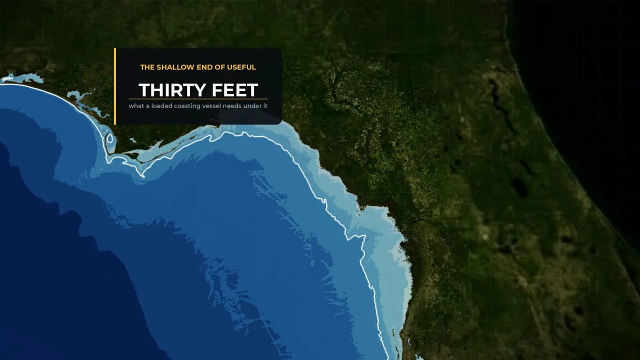
Measure the water exactly 3.1 miles from the beach. Off Pensacola it is 67 feet deep and off Jacksonville Beach 55. Off the Suwannee it is 12 feet, off Keaton Beach six, and off Cedar Key a foot and a half. The cause is slope. The inner shelf here drops one foot for every 5,000 feet out, so nearly level that 100 miles off Keaton Beach the water is still only 130 feet deep. Thirty feet is the shallow end of what a ship can use. Off Jacksonville Beach that depth is three-tenths of a mile from the sand; off Cedar Key it is 15.8 miles out. A port here means 12 to 27 miles of canal through limestone.
Watch this part · 3:59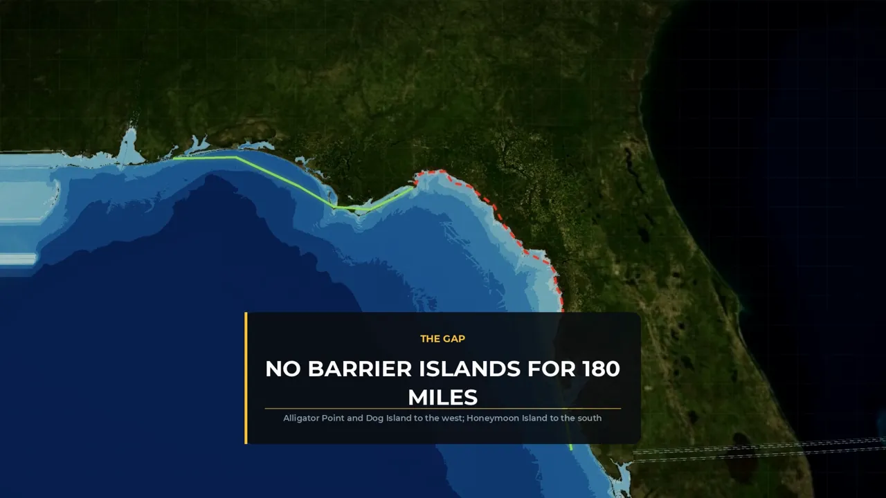
No barrier islands for 180 miles 2 of 6
Why no sediment means no harbour
The Big Bend is a coast that was flooded, not built. It is drowned karst, a flat limestone plateau the sea rose over, so the shoreline sits wherever the water stopped. Sediment is the raw material a harbour is made from, and these rivers carry almost none. Even the Suwannee, the biggest, drains a swamp and a limestone aquifer, not mountains. No sediment means no delta, no bar and no spit. There are no barrier islands either, and a barrier island is what makes a harbour: a sheltered sound behind it and a tidal inlet that scours itself deep. The waves are too small to pile sand into barriers, and the rock bottom has to be blasted rather than dredged.
Watch this part · 6:45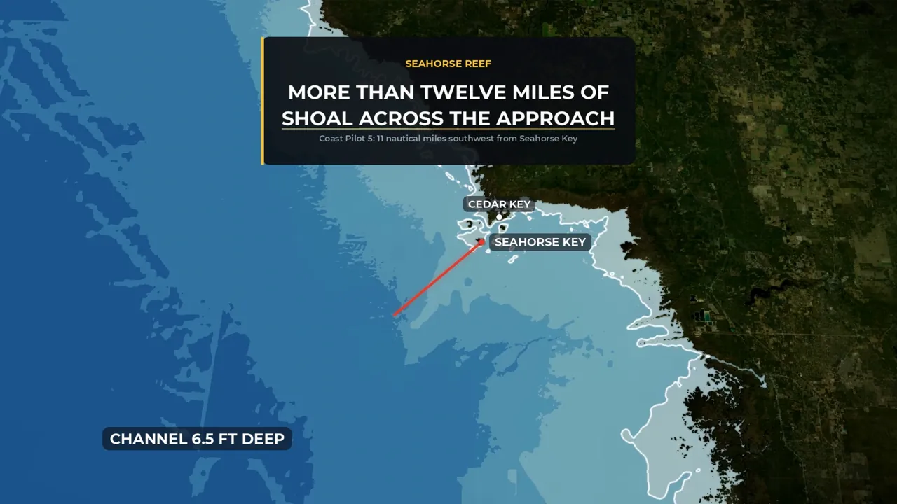
6.5 ft channel, 50 at Mobile 3 of 6
A shallow channel limits what can ship
A channel is only as useful as its shallowest stretch, its controlling depth. Cedar Key's Main Ship Channel, the deepest public channel on the whole arc, holds six and a half feet, against 50 feet into Mobile Bay and 47 at Jacksonville, and Seahorse Reef throws more than twelve miles of shoal across the approach. Cedar Key boomed anyway, with seventeen sawmills by 1886 and fifth place among Florida ports, because a schooner could get in and the cargo, red cedar for pencils, was light, dry and valuable. It was a railhead with a shallow channel, never a harbour. When the cedar ran out, the mills had nothing left to mill.
Watch this part · 16:47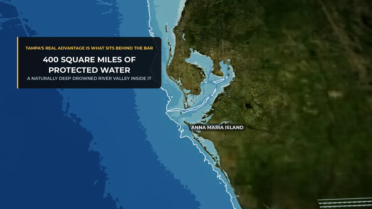
400 square miles of protected water 4 of 6
The basin mattered more than the approach
Tampa did not win on deep water at the door. Its approach is gentle too: the natural 30-foot line lies 7.5 miles off Anna Maria Island, against Cedar Key's 15.8. The difference is behind the bar. Tampa Bay is 400 square miles of protected water with a naturally deep drowned river valley inside, entered between two barrier islands through Egmont Channel. Dredge a bar a few miles long and you inherit all of it. On the Big Bend you dredge 25 miles of channel and inherit a marsh. David Yulee chose Cedar Key because its water was deeper than Tampa's, but Henry Plant, whose railroad ran to Tampa from 1884, was buying a basin.
Watch this part · 19:22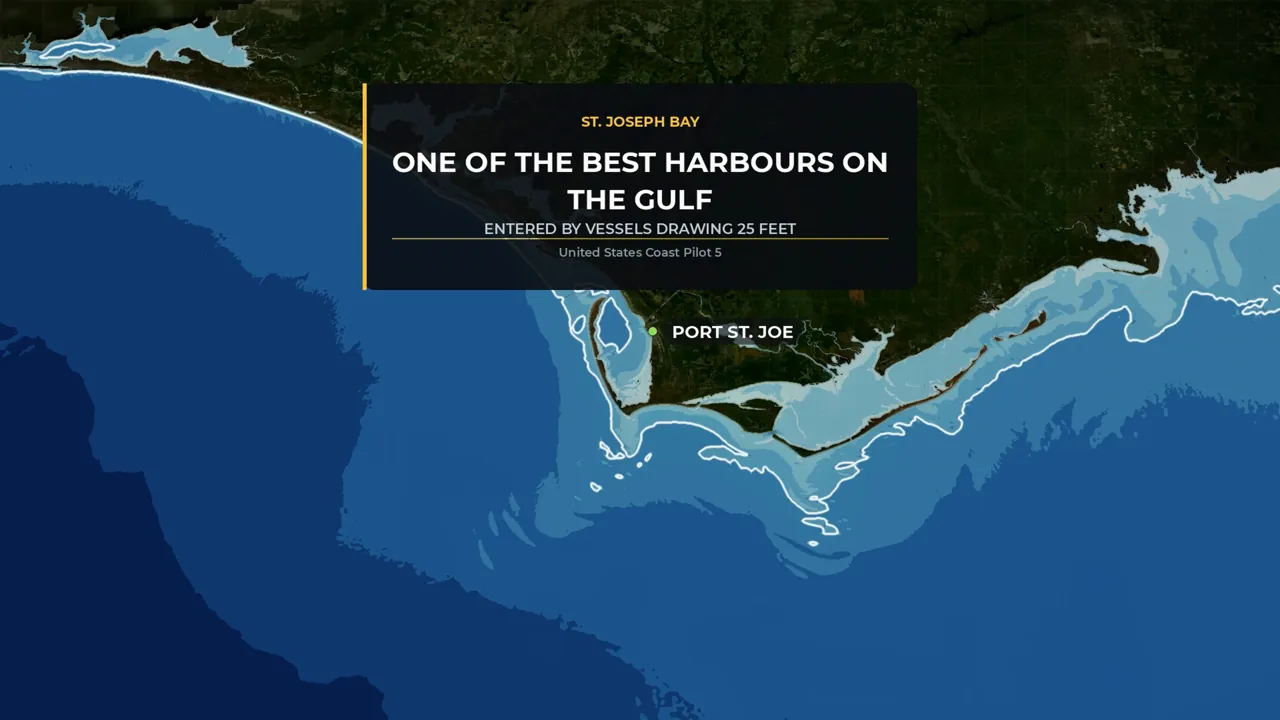
30-ft line 1.9 miles offshore 5 of 6
Deep water is needed but not enough
Port St. Joe, sixty miles west, is the control experiment. It sits on the far side of the hinge at Cape San Blas, where the coral formation gives way to sand, and the natural 30-foot line is just 1.9 miles offshore. St. Joseph Bay is recognised as one of the best harbours on the Gulf, entered by vessels drawing 25 feet. It failed anyway. When the paper mill, the only thing shipping, closed in 1998, the port closed with it. The federal channel is authorised to 37 feet; the last survey found 24. A port needs the water, the cargo, the railroad and someone who keeps paying for the dredge. The Big Bend never had the water.
Watch this part · 21:18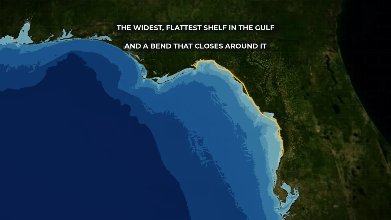
9.3 ft at Cedar Key in Helene 6 of 6
The same shelf makes the storm surge
A long, gently sloping bottom amplifies the tide as it shoals, which is why the mean tidal range at Cedar Key is 2.83 feet, against 1.59 at Tampa. Surge height grows with the width and shallowness of the water the wind drives across, and the Big Bend has the widest, flattest shelf in the Gulf, with a bend that closes around it. When Helene came ashore as a Category 4, the Cedar Key gauge read 9.3 feet above normal high water, the highest since it was installed in 1914. One piece of rock, two results: no harbour, and the worst surge coast in the country. But the storms did not empty this coast. There was no city here before them.
Watch this part · 33:49
Explore
The map from the film
Turn the film's layers on and off, switch to satellite, and click anything for what it is.
Chapters
Jump to any part
- 01Why 180 miles of Florida has no port0:00
- 02Three miles out3:59
- 03Nothing to build a harbour out of6:45
- 04Port Leon lasted six years11:23
- 05The fifth-busiest port in Florida15:00
- 06January 188418:44
- 071896, and five maps22:30
- 08The mouth of the Withlacoochee25:34
- 09What they built instead29:30
- 10The same shelf, seen twice33:49
- 11To sum it all up37:18
Names
How locals say them
How locals say the names the narration got wrong. Most of these came from viewers; thank you.
| Name | How locals say it | Note |
|---|---|---|
| St. Marks, Port St. Joe (and every "St.") | Saint | Read as an abbreviation, with a pause at the period. |
| Ochlockonee | ock-LOCK-uh-nee | Viewer correction. |
| Apalachee | ap-uh-LATCH-ee | Viewer correction. |
| Wakulla | wah-KULL-uh | Viewer correction. |
| Aripeka | air-uh-PEE-kuh | Viewer correction. |
| Inglis | ING-lis | Viewer correction. |
| Steinhatchee | STEEN-hatch-ee | Local usage. |
| Withlacoochee | with-luh-KOO-chee | Local usage. |
| Okefenokee | oh-kee-fuh-NO-kee | Local usage. |
Transcript
Read the film
The full narration, chapter by chapter. Click a time to play from there.
01Why 180 miles of Florida has no port0:00
0:00Florida has about thirteen hundred and fifty miles of coastline, and it has put a city on nearly all of it. Jacksonville, Miami, Fort Lauderdale, Naples, Fort Myers, Sarasota, Tampa, Panama City, Pensacola. And then there is this. From the mouth of the Ochlockonee River, where the panhandle ends, running south a hundred and eighty miles to a fishing hamlet called Aripeka, there is not one incorporated town on the water with five thousand people in it. It is not for lack of trying. Six times, people put serious money into this coast. A railroad. A port. A canal across the state, of which three per cent got built.
0:48A nuclear plant that reached twenty-four billion dollars on paper, and cost customers eight hundred million dollars before it was cancelled, for a plant that never produced a single kilowatt. Every one of them failed. The reason was settled before any of them got here, it has nothing to do with hurricanes, and you can measure it three miles off the beach. Just over three miles off the beach at Cedar Key, Florida, the water is a foot and a half deep. Go just over three miles off Pensacola Beach, the same state and the same sea, and you are floating over sixty-seven feet of water.
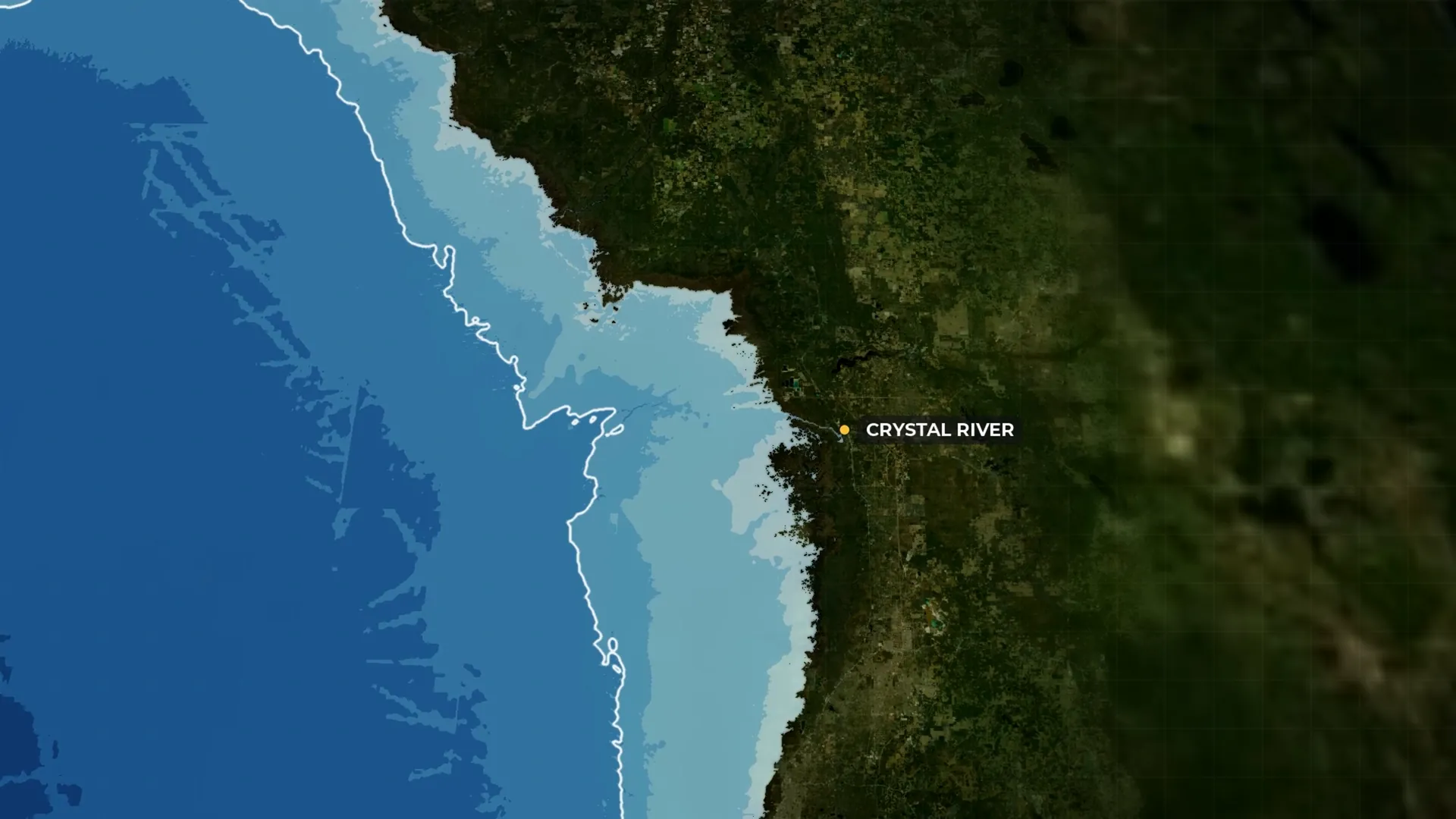
1:30And that same floor does one other thing to this coast, which is the reason the parenthetical in the title is there. Hold on to it. The largest is Crystal River, at three thousand six hundred and sixty-one, and it falls away fast from there — Inglis, Cedar Key, Yankeetown, Sopchoppy, St. Marks — down to Horseshoe Beach, which has a hundred and seventy-three people in it. Nineteen miles further south the pattern breaks, and it breaks hard. New Port Richey has eighteen thousand people in it, which is exactly why this line is drawn at a hundred and eighty miles rather than two hundred.
2:12Go past Aripeka and you are back in ordinary Florida. There is no deepwater port on those hundred and eighty miles either, and there never has been one that lasted. The deepest public channel on the whole arc is the Main Ship Channel at Cedar Key, and its controlling depth down the centreline is six and a half feet. Six and a half feet, against fifty feet into Mobile Bay as of October 2025, and forty-seven at Jacksonville. The deepest cut of any kind ever made here is a private channel fourteen miles long, dug for a power plant and reported at twenty feet.
2:54Apalachee Bay, at the top of the arc, is the one every early attempt tried to use, and the federal navigation manual describes it in a sentence that has not needed rewriting in a century: depths range from six to twenty feet, with numerous shoals and rocks, some bare at low water. That is not a description of a difficult harbour. It is a description of something that is not a harbour at all. And the missing harbour is the reason for the missing town, because a port puts a railhead on a coast and a railhead puts a city on the railhead, and here the first link was never there at all.
3:35Everyone who arrives at this stretch of Florida assumes the answer is hurricanes. It isn't. Whatever it is, it settled the question long before anyone tried, and it is still down there. So the real question is not why nobody built a port here. It is what one would have cost — and who was ever willing to pay it.
02Three miles out3:59
3:59So let's get in the water and find out what the problem is, because it is not subtle. Pick one fixed distance from the beach — three point one miles — go out that far at ten places on the Gulf, and read the depth underneath you. Off Santa Rosa Island at Pensacola there are sixty-seven feet of water under the keel. Off Jacksonville Beach, fifty-five. Off Dauphin Island at the mouth of Mobile Bay, forty-two. Now the Big Bend, at the identical distance from the identical kind of shoreline.
4:36Off the mouth of the Suwannee, twelve feet. Off Keaton Beach, six. And off Cedar Key, a foot and a half — shallower than a rowing boat is wide, three miles from land. That is the floor of the Gulf of Mexico, and it is the whole answer. So how far out do you have to go to find water a ship can use? Thirty feet is the shallow end of useful. Off Jacksonville Beach, the thirty-foot contour sits three-tenths of a mile from the sand. Off Cedar Key it is fifteen point eight miles. So on this coast a port is not a harbour project.
5:16It is a canal project — twelve to twenty-seven miles of canal, cut through limestone rather than mud, and then maintained against silt forever, in exchange for a town that does not exist yet. The navigation manual gives sailors a rule of thumb for finding Pensacola from seaward: if you are in sixty feet of water less than three miles off the beach, you have come in east of the entrance. Sixty feet, three miles. Off Apalachee Bay, that same sixty-foot line lies as much as twenty-two miles out.
5:53And it does not improve if you keep going. You can sail a hundred miles straight out from Keaton Beach, long past the point where Florida drops below the horizon, and still be in a hundred and thirty feet of water. The published slope of the inner shelf here is one in five thousand, which is so nearly level that the literature stopped calling it a coast and started calling it an incipient epicontinental sea. The two deepest cuts anyone ever made here are that private channel to the power plant and a barge canal approach eight and a half miles long.
6:32Neither reached open deep water. So the question is not really why nobody built a port here. It is what one would have cost, and who was willing to try to pay it.
03Nothing to build a harbour out of6:45
6:45So why is the bottom of the Gulf flat here and steep along the panhandle? Because the Big Bend is not a coast that was built. It is a coast that was flooded. The whole region is drowned karst — limestone at or just under the surface, on land and on the bottom. This is not a shoreline a river piled up at its mouth; it is a flat limestone plateau the sea rose over, and the waterline is wherever the sea happened to stop. There is no edge anywhere. Now, four things here sound like advantages, and every one of them is the reason there is no port.
7:25The first is that the rivers carry almost no sediment. The Suwannee is much the biggest, at nine thousand seven hundred cubic feet a second, and it is still useless, because it drains the Okefenokee Swamp and a limestone aquifer rather than a mountain range, and the controlling depth in its entrance channel was four feet. No sediment means no delta, no bar, no spit and no beach ridge — no raw material for the landform that makes a harbour. The second is that there are no barrier islands.
8:00They run the Gulf coast west of the Ochlockonee as Alligator Point and Dog Island and resume south of Anclote Key as Honeymoon Island and Clearwater Beach, and between those points, along the entire hundred and eighty miles, there are none. That matters more than it sounds, because the barrier island is the harbour-making machine: a protected sound behind it, and a tidal inlet that scours itself deep. The third is that the waves are small. Low wave energy is normally what a port wants, and here it is the problem, because waves are what pile sand into barriers and keep an inlet swept clear.
8:43Take them away and whatever you dredge silts up and stays silted. The calm is why there is no harbour. And the fourth is that the bottom is rock rather than mud, broken and irregular for about eleven and a half miles out, with coral heads and reefs numerous — St. Martins Reef alone throws shoals that far offshore along forty-six miles of coast. Dredging soft sediment is one price; blasting limestone is another entirely, and it is why every channel here is narrow, crooked and shallow.
9:20And where a beach would be there is salt marsh instead, one to two miles wide and backed by pine forest, so there is nothing to build a wharf on and nothing to build a hotel on either — the second reason this coast stayed empty while the rest of Florida filled up with tourists. The shortest demonstration of that is a film shoot. In the summer of 1961 Elvis Presley came to Yankeetown to make a picture called Follow That Dream, and the script wanted a beach. There wasn't one, so the crew trucked in white sand and built one, and the road into town is called Follow That Dream Parkway to this day.
10:01A film unit with money and a deadline could not find a beach on a hundred and eighty miles of Gulf coast. Even the fresh water arrives the wrong way, seeping up through the limestone and out through the seabed rather than down one deep river, so there is never a concentrated flow to keep a channel open. And the line where this ends is sharp: the coral formation gives way to sand at Cape San Blas. West of that hinge, Panama City and Pensacola and Mobile. East and south of it, limestone, and this.
10:38So the geology set the price of a port here impossibly high, and for a hundred and fifty years people kept trying to pay it anyway. Six attempts are worth naming now, because each one is a different way around the missing harbour and each one costs more than the last. A railroad down to tidewater. A trade route cut clean across the peninsula. A phosphate port at a river mouth. A ship canal through the middle of the state. A paper mill. And a nuclear plant. Not one of them is a harbour. Every one is an attempt to do without one, and each fails on a different part of the same trap.
04Port Leon lasted six years11:23
11:23The first answer is the cheapest one on the list, and it is the obvious one: if the ships cannot come inland, take the cargo out to them. The Spanish had known about the one usable notch in this coastline since 1679, when the governor of Florida began building Fort San Marcos de Apalache where the Wakulla and the St. Marks meet. A hundred and fifty years later the cotton planters around Tallahassee wanted the same notch for the same reason: it was the nearest salt water the capital had.
11:59So they built a railroad to reach it. The Leon Railway Company took out the first railroad charter ever issued in Florida in 1831, raised a hundred thousand dollars of stock, and ran a line twenty-two miles from Tallahassee down to the coast at St. Marks. By 1837 it was moving about thirty thousand bales of cotton. They bought a locomotive that December. On its first trip out of the Tallahassee depot the cap of the boiler exploded with a tremendous report, and that was the end of the experiment.
12:39Mules pulled Florida's first railroad for more than twenty years after that, until steel rails and real locomotives arrived in 1856. But the mules were never the problem. The problem was at the far end of the line. The cotton came down to tidewater and the ships could not come in to get it. So in 1839 they extended the line over a new drawbridge to a brand-new terminus further down the river, called it Port Leon and advertised it as deepwater. Lots went on sale, the town filled up, and the population climbed toward four hundred and fifty.
13:20Then in 1841 a steamboat passenger arrived from Key West carrying yellow fever. Over three months the population fell below two hundred, and of the people who stayed, a hundred and thirty-nine died. What finished it came two years later. In September of 1843 a ten-foot tidal surge destroyed every dwelling in the town and pushed the railroad bridge upriver. Fourteen people were killed. The New York Herald ran the story under a headline that is a complete summary of this entire coast: Terrible Storm in Florida — Total Destruction of a Town — Fourteen Lives Lost.
14:03The survivors held a meeting and voted not to rebuild. They moved four miles north to a sulphur spring, started again and called the new place Newport, and nothing whatever remains of the old one. The railroad itself outlasted everybody. It ran for a hundred and forty-six years, longer than any other line in Florida, and when it stopped in 1983 the state paved sixteen miles of it as a bicycle trail. The town it was built to serve, St. Marks, has three hundred and twelve people in it today, and the navigation manual's verdict on the river is one sentence long: barges constitute the major traffic on the river.
14:50That is the first answer used up. A railroad can reach the water. It cannot make the water any deeper once it gets there.
05The fifth-busiest port in Florida15:00
15:00So the second answer is bigger: if the water at the end of a short line is no good, build a very long line instead, clean across the state, and let the cargo leave through somebody else's ocean. On the way to doing that, one town on this coast beat the geology completely for twenty years. The first organised settlement at Cedar Key was bought rather than founded. In 1843 a man named Augustus Steele paid the Army two hundred and twenty-seven dollars for the buildings it had put up on a small island called Atsena Otie, and moved in. That is the whole founding story: two hundred and twenty-seven dollars and some second-hand army buildings.
15:47What changed it was a railroad, and a very unusual one. David Levy Yulee wanted a line clean across the Florida peninsula, Atlantic to Gulf, so cargo could skip the long sail around the Keys. Construction started in 1855, the first train reached the Gulf end in March of 1861, and Cedar Key became a company town at the western end of the first cross-peninsula railroad in the state. Then came the thing worth carrying. The hammocks inland along the Suwannee grew red cedar, and red cedar is what pencils were made of. Eberhard Faber set up a cedar-slat mill on Atsena Otie in 1865 and the Eagle Pencil Company built another on Way Key across the channel, and for about twenty years a large share of the pencils in America began on two small islands off the Florida coast.
16:47The boom was real. By 1886 there were seventeen sawmills around Cedar Key turning out nearly half a million board feet a week, and the town ranked fifth among all Florida ports, behind only Jacksonville, Fernandina, Pensacola and Key West. The population went from about four hundred to near five thousand at the peak in 1888. So what was Cedar Key actually? It was never a harbour. It was a railhead with a shallow channel and a resource worth carrying, and the channel was six and a half feet deep, with Seahorse Reef throwing more than twelve miles of shoal across the approach.
17:31It worked because a schooner could get in and the cargo was light, dry and valuable, and it worked for exactly as long as all three held. And hold on to that shelf, because the flat bottom that pinned this channel at six and a half feet does one other thing to this coast — the thing everybody thinks emptied it. We come back to it at the end. Nobody gave any thought to replanting the cedar, and when it ran out the mills had nothing left to mill — the pattern for every boom this coast has had: cotton, cedar, yellow pine, phosphate. Each one was a mine rather than an economy.
18:12Fifty miles inland, Ellaville had the largest sawmill in Florida when it was built in 1865, plus a railway station, two schools, two churches, a steamboat dock and something like a thousand residents. The state's own historical marker writes the obituary in one line: it flourished as long as yellow pine lasted, declined after 1900, and ceased to exist when the post office closed in 1942.
06January 188418:44
18:44Now, the decision that actually killed the Big Bend was taken a hundred and thirty miles to the south, and it had nothing to do with weather at all. Henry Plant's South Florida Railroad opened its Tampa end in December of 1883, ran the full line from the twenty-fifth of January, 1884, and two years later added steamships to Key West and Cuba. A railroad from the interior and a fleet leaving the dock ended Cedar Key's run as the Gulf coast's main shipping destination. Plenty of ports begin behind shallow water.
19:22What matters is what a dredged channel buys you. So what did Tampa have that Cedar Key did not? Not deep water on the approach, which is the easy answer and the wrong one. Tampa's approach from the Gulf is the gentlest of any place in this comparison: the natural thirty-foot contour off Anna Maria Island is seven and a half miles offshore, better than Cedar Key's fifteen point eight, but nobody's idea of a bold coast. Tampa's real advantage is what sits behind the bar. Tampa Bay is four hundred square miles of protected water with a naturally deep drowned river valley inside it, entered between two barrier islands through Egmont Channel. You dredge a bar a few miles long and you inherit four hundred square miles of sheltered deep water. On the Big Bend you dredge twenty-five miles of channel and you inherit a marsh.
20:22Shallow water does not stop a port. A long, rocky, unprotected approach with nothing deep behind it does. The population figures show how much that mattered. In 1880 Tampa had seven hundred and twenty people in it, while Cedar Key had thousands, seventeen sawmills and a railroad to the Atlantic. Ten years later Tampa had five and a half thousand, and today it is spending more than a billion dollars deepening its channel. And here is the detail that makes it sting. David Yulee chose Cedar Key for his Gulf terminus because the water there was deeper than Tampa's. He was right about the water and it did not matter in the slightest, because Plant was not buying an approach, he was buying a basin, and inside twenty years the town Yulee built was finished.
21:18But before we let deep water take all the credit, there is a place sixty miles west that runs the control experiment, and its name is Port St. Joe. St. Joseph Bay is recognised as one of the best harbours on the Gulf, entered by vessels drawing twenty-five feet, and it sits on the far side of the hinge at Cape San Blas, where the natural thirty-foot contour is one point nine miles offshore. So Port St. Joe had the one thing the Big Bend never had, and it failed anyway. The paper mill closed in 1998, the port closed with it because the mill was the only thing shipping, and five hundred and fifty people lost their jobs. The federal channel is authorised to thirty-seven feet; the last survey found twenty-four.
22:13Which gives us the honest version of the rule. Deep water is necessary and it is not sufficient: you need the water and the cargo and the railroad and somebody who keeps paying for the dredge. The Big Bend never had the first of the four.
071896, and five maps22:30
22:30Which brings us to the storm, and the thing most people get backwards about it. In September of 1896 a hurricane came ashore at Cedar Key with winds of a hundred and twenty-five miles an hour and about ten and a half feet of storm surge. It washed out the railroad connection to the mainland and killed more than a hundred people. A fire that December finished what was left of the waterfront, and the Faber mill closed and never reopened. But read the order of events, because the order is the argument.
23:08Plant's steamships started running to Cuba in 1886, and the cedar the mills depended on had already been cut out, so by the time the hurricane arrived the town had lost the shipping trade and exhausted the thing it sold. The storm did not create the problem. It collected on a debt owed for ten years, and what it removed was the option of rebuilding. The population numbers say it plainly: near five thousand in 1888, and about twelve hundred by 1896. There is a better way to see this than any number, and it is five insurance maps.
23:48Fire insurance surveyors drew the same Cedar Key waterfront in 1884, 1890, 1909, 1920 and 1933, to the same standard each time, block by block, labelling every mill and wharf. Watch the same few blocks across those five sheets. The mills are there at full extent in the first two. By 1909, they are not being rebuilt. By the last two the waterfront is a small fishing town where an industrial port was supposed to be, and nobody has to say a word about it. The railroad hung on for another generation and then it stopped too.
24:32It was abandoned in 1932, and the population settled at about nine hundred. Today Cedar Key has seven hundred and thirty-six residents. So the second answer is used up as well. A railroad can cross an entire state, and the shelf at the end of it still decides what a ship is allowed to do. And there is a last piece that is easy to miss. The town is not on the island it started on. The original settlement was on Atsena Otie Key, a few hundred yards offshore, and after 1896 the survivors floated what was left of their houses across the channel and rebuilt on Way Key. Atsena Otie was never resettled.
25:19It is eight hundred acres of national wildlife refuge now, and you can walk up from the dock past a brick cistern dome and a cemetery, and that is the entire remains of the first attempt at a town on this coast.
08The mouth of the Withlacoochee25:34
25:35One river mouth carries the third answer and the fourth, three miles apart, and between them they are the largest attempts ever made on this coast. The third answer needed a cargo heavy enough to justify almost anything, and in 1889 a prospector found one: hard-rock phosphate at Dunnellon, forty miles inland. Phosphate is a bulk commodity, which means it needs a ship, and this coast finally had a reason worth solving its problem for. What got built was Port Inglis, opened in 1902 on Chambers Island at the mouth of the Withlacoochee, where phosphate barged down the river went into rail cars and ocean-going ships. It handled five vessels in its first year, and fifty-six in 1905.
26:26And 1905 is the year worth putting on screen, because the customs record survives. That year Port Inglis shipped a hundred and eighty-five thousand tons of phosphate to Germany and Belgium and Holland, under British and Spanish and Danish flags. That is the only time in the history of these hundred and eighty miles that anything has moved ocean cargo at volume. It lasted about twenty years, and then it went. The island held seventy-seven acres when it was bought; seven and a half acres of dry land are left.
27:05Three miles away is the fourth answer, by far the biggest thing ever tried here, and it was not a port at all. It was an attempt to cut the state in half. The reasoning was that if the Gulf coast would not give you a harbour, you should stop trying to use the Gulf coast: cut a canal straight across the peninsula, from the Withlacoochee to the St. Johns, and let the cargo pass through. Franklin Roosevelt released relief money in 1935 and eight thousand men went to work on a sea-level channel through the aquifer, and then Congress declined to authorise it and the money stopped, three percent complete — a few thousand acres of cleared land and four concrete stanchions of a bridge over a waterway that did not exist.
27:56It was tried again in 1964 as a barge canal, lifting boats over the aquifer on locks instead of cutting down through it. Three of the locks were built, the two at the summit were never begun, and the money ran out a second time. In July of 1970 the Florida Canal Authority staged a demonstration for reporters, in which a three-hundred-and-fifty-foot barge called the Aiple would run the finished western section. Nobody had checked whether the Aiple fitted through Inglis Lock. It did not, and it stuck sideways, in front of the press, for hours.
28:36It ended in a courtroom. A federal judge granted an injunction from the bench in January of 1971, and the bond required to stop a project that size was one dollar. The White House announced a halt four days later. Congress deauthorised the canal in 1990 and made Florida set aside seventy-seven thousand acres of the route for conservation, so the failed canal now forecloses the next one. Inglis Lock has been shut since 1999, and the approach channel still runs eight and a half miles out into the Gulf and stops. Four answers down, two to go — and the floor that killed all four is still holding the thing we have not got to yet.
29:24Which leaves two answers on the list, and neither of them involves a ship at all.
09What they built instead29:30
29:30Once ships were impossible, industry had two ways left to use this coast: take its water, or dump into it. The fifth and sixth answers each did one, and in both cases the water they used instead of a harbour is what finished them. The fifth begins with a river that a state legislature deliberately demoted. In 1947 Taylor County's delegation got a special act through declaring the county an industrial area, and granting anyone operating a plant there the right to discharge sewage and industrial and chemical waste into the Fenholloway River and the Gulf it runs to. It passed without debate.
30:15That is a small river to hang a county on — about one-fiftieth of the Suwannee, with a draft of three feet on a favourable tide. But shipping was never the point. The Fenholloway became the only river Florida ever classified for industrial use, and the category still exists with nothing in it. And it worked, in the sense that the investment arrived. Procter & Gamble started building the Foley pulp mill in 1952 and made its first product two years later, forty million dollars on a twenty-nine-hundred-acre site outside Perry. By the mid-1960s it employed eight hundred and seventy-five people and paid more than half of all the taxes in Taylor County, and it ran on water rather than ships — fifty million gallons a day discharged, and the same volume pulled back out of the aquifer through seven wells.
31:14And there is a way to know exactly what that did, because the Fenholloway has a twin. The Econfina rises in the same swamp, drains the same rock and reaches the same Gulf a few miles west, and it never got a mill, so biologists have used the pair as a natural experiment. Downstream of the mill, eighty percent of female mosquitofish were partially masculinised and another ten percent completely so, growing a fin only males should have. Locals called them bearded lady fish. In September of 2023, Georgia-Pacific announced that the Foley mill would close permanently, eighteen days after Hurricane Idalia came ashore twenty miles south, and the company states that the decision preceded the storm.
32:05Five hundred and twenty-five direct jobs went, along with twenty-eight percent of the county's tax base. The sixth answer was a nuclear plant, and it failed the same way: it needed water rather than a harbour, and the water it chose was the dead barge canal. Progress Energy announced two reactors in Levy County, cooled from the canal two miles north, at fourteen billion dollars. The estimate reached twenty-four point seven billion before it was cancelled in 2013. Then the paperwork caught up. The Nuclear Regulatory Commission issued the licences for both reactors three years after the project was cancelled, and they were handed back two years after that. Customers had by then paid roughly eight hundred million dollars toward a plant that never produced a kilowatt, and none of it was refunded.
33:03Duke still owns the land. That leaves the land itself. In 2015 the timber company that grew out of the mill's forests sold five hundred and sixty thousand acres across five counties, for at least seven hundred and ten million dollars, to a single buyer. That one holding covers more than half of Taylor County — one owner with more of the county than everybody else put together. Land held in one block and grown for timber is land that is not platted, not sold and not built on. The shelf is why nothing was built on the water here; the ownership map is a good part of why so little has been built behind it since.
10The same shelf, seen twice33:49
33:49So let's go back to the parenthetical in the title, because the hurricanes are not a separate subject. They are the same fact read from the other end. Start with something that happens here every day and has nothing to do with storms. The mean tidal range at Cedar Key is two point eight three feet, against one point five nine at Tampa — roughly double, on the same sea, and the only variable that changes is the shelf, because a long, gently sloping bottom amplifies the tide as it shoals.
34:24Now push a hurricane across that. Surge height scales with the width and shallowness of the water the wind drives across, and the Big Bend has the widest, flattest shelf in the Gulf and a bend that closes around it. The warning is printed in the navigation manual rather than a storm report: tides here have run twelve to fifteen feet above normal in the bight of Apalachee Bay. Three storms in thirteen months landed on the same sixty miles of it. Idalia came ashore near Keaton Beach in 2023 as a Category 3 and put eight to twelve feet of water over the ground as far as Steinhatchee.
35:07Debby landed a year later as a Category 1 — the weakest kind there is — and still raised the water at Cedar Key six feet above normal tide. Helene came ashore ten miles west of Perry that September as a Category 4, with twelve to sixteen feet at landfall. The gauge at Cedar Key measured nine point three feet above normal high water that night, the highest level recorded there since it was installed in 1914. So the geometry that makes a sixteen-foot surge out of a Category 4 is the identical geometry that puts forty feet of water thirty miles offshore.
35:49One piece of rock, two consequences: no harbour, and the worst surge coast in the country. But did the hurricanes empty this coast? They did not. There was no city here before any of these storms, and Miami and Tampa and Pensacola are hurricane coasts and became cities anyway. What the coast got instead of a port is protection, and the scale of it is why there will not be a port now. The Big Bend Seagrasses Aquatic Preserve covers roughly a million acres of state-owned submerged land, the largest in Florida, and St. Marks National Wildlife Refuge holds forty-three miles of Gulf coast — a quarter of the arc in one federal holding.
36:37And the Cross Florida Greenway, all hundred and ten miles of it from Yankeetown to the St. Johns, means the failed canal is now conservation land. And then somebody finally found a way to sell it. In 1991 the chambers of commerce of nine towns sat down with a list of more than a dozen names for the region and chose the one that marketed its undeveloped areas. They called it the Nature Coast. After a hundred and fifty years of trying to sell this shoreline as a port, they had found the one thing it could sell, which was the absence of one.
11To sum it all up37:18
37:18So, to sum it all up. A hundred and eighty miles of Florida could never keep a port because the sea floor there is a flooded limestone plateau, not a built coastline — no sediment, no barrier islands, no self-scouring inlet, and no deep water within twelve to twenty-seven miles of the beach. Six answers were tried against that, from a mule-drawn railroad to a nuclear plant, and every one failed at the waterline, or at the money, or at the water it used instead. The dark stretch on that night map is not where Florida forgot to build.
37:56It is where the floor of the Gulf said no, over and over, to everybody who asked. Thanks for joining me today. Subscribe so you don't miss what's coming next, and I'll see you next time.
Your story
What did we miss?
The best things we have learned since publishing came from people who live there: family who worked the mills, the river everyone knows we forgot, the date we got wrong. Tell us yours.
Quiz
How well do you know Florida?
A few questions the film answers. Nothing is recorded; it's just for fun.
1 of 6 · Guess the number
Three miles off the beach at Cedar Key, how deep is the Gulf?
A foot and a half. Go the same distance off Pensacola Beach, in the same state and the same sea, and you float over sixty-seven feet of water.
Watch this part · 0:482 of 6 · Tap the map
Tap where you think the water first gets 30 feet deep off Cedar Key.
Thirty feet is the shallow end of what a ship can use. The film measures it 15.8 miles out from Cedar Key; off Jacksonville Beach it is three-tenths of a mile.
Watch this part · 4:363 of 6 · Say it like a local
Say it like a local: the river where the stretch begins, Ochlockonee.
ock-LOCK-uh-nee. Our narrator got this one wrong, and viewers set us straight.
Watch this part · 0:004 of 6 · Question
What was Tampa's real advantage over Cedar Key?
Tampa Bay is 400 square miles of protected water with deep water inside. Its approach was gentle too, with the 30-foot line 7.5 miles out. Plant was buying a basin, not an approach.
Watch this part · 19:225 of 6 · Tap the map
Port St. Joe had deep water and still lost its port. Tap where you think it is.
The paper mill was the only thing shipping, so when it closed the port closed with it. Deep water is necessary but not sufficient. It sits about sixty miles west of the Big Bend, past Cape San Blas.
Watch this part · 21:186 of 6 · Question
Did hurricanes empty the Big Bend coast?
No. There was no city here before any of these storms, and Miami, Tampa and Pensacola are hurricane coasts that became cities anyway. The shallow shelf is what kept a port away.
Watch this part · 35:49Sources & credits
Where it comes from
- Map imagery: NASA Blue Marble / Black Marble; USDA NAIP via the USGS National Map (public domain).
- Elevation and sea floor: NOAA NCEI DEM Global Mosaic / CUDEM (public domain).
- Map data: Natural Earth, US Census Bureau; © OpenStreetMap contributors (ODbL).
- Chart data: US Census Bureau population estimates; NOAA tide station 8727520, Cedar Key.
- Music: Ambient - Ambient Music by AtlasAudio; Ambient Cinematic by AtlasAudio; Ambient Cinematic by VelarioMusic; Calm Ambient by Kulakovka; Documentary - Documentary Music by PaulYudin; Documentary Cinematic by leberch; Documentary by NastelBom; Documentary by SigmaMusicArt; Geography by The_Mountain; Piano Documentary by The_Mountain; Science Documentary by leberch (Pixabay).
- Images (Creative Commons):
- • Keaton Beach coast by DiscoverTaylor (CC BY-SA 4.0) https://commons.wikimedia.org/wiki/File:Keaton_Beach_coast.jpg
- • Steinhatchee, Florida, aerial by formulanone (CC BY-SA 2.0) https://commons.wikimedia.org/wiki/File:Steinhatchee_Florida_Aerial.jpg
- • Wakulla Springs by Hannes Grobe (CC BY 3.0) https://commons.wikimedia.org/wiki/File:Wakulla-springs_2009-05-03T23_48_20.jpg
- • Manatee Springs State Park by Michael Rivera (CC BY-SA 4.0) https://commons.wikimedia.org/wiki/File:Manatee_Springs_State_Park_2016_a.JPG
- • Old Tallahassee-St. Marks Railroad rails by The Bushranger (CC BY-SA 4.0) https://commons.wikimedia.org/wiki/File:Old_Tallahassee-St_Marks_Railroad_rails.jpg
- • Atsena Otie Key seen offshore from Cedar Key by Ebyabe (CC BY-SA 3.0) https://commons.wikimedia.org/wiki/File:Cedar_Key_FL_Atsena_Otie_offshore01.jpg
- • Cedar Key aerial by formulanone (CC BY-SA 2.0) https://commons.wikimedia.org/wiki/File:Cedar_Key_Aerial.jpg
- • Atsena Otie Key: cistern dome ruin by Ebyabe (CC BY-SA 3.0) https://commons.wikimedia.org/wiki/File:Cedar_Key_FL_Atsena_Otie_dome01.jpg
- • Georgia and Florida Railway crossing Buckeye Nursery Road, Perry by The Bushranger (CC BY-SA 4.0) https://commons.wikimedia.org/wiki/File:Georgia_and_Florida_Railway_crossing_Buckeye_Nursery_Road%2C_Perry.jpg
- • Red clouds at sunrise over Apalachee Bay, St. Marks NWR by James Leon Young (CC BY-SA 4.0) https://commons.wikimedia.org/wiki/File:Red_clouds_at_sunrise_over_Apalachee_Bay_St._Marks_NWR_2020-07-22.jpg
- Other images: public domain or no known restrictions — Library of Congress, National Archives, State Archives of Florida (Florida Memory), Wikimedia Commons.